Saturday, December 7, 2013

Incremental Urbanism is the Key to California's Future

Incremental Urbanism in Washington DC
(Source: Wikipedia)

I am a big proponent of Incremental Urbanism, which is the creation of great places on a lot-by-lot basis, by dozens or hundreds of land owners and developers over time. Many of our favorite historic cities were built this way, and they still work very well today.

I just wrote a blog post for the California Chapter of the Congress for the New Urbanism. As you may know, CNU is famous for large, beautiful, walkable, master-planned projects. Things have changed, though, and these opportunities are dwindling in California. I believe that California's new frontier is on small, non-contiguous infill sites within our existing towns, cities, and metropolitan areas. Can we pivot and master this new realm? I propose that it is essential that we do, and in my CNU-CA blog post I explore how it can be done. Check it out here.


Tuesday, December 3, 2013

Housing Affordability at the Breaking Point - Part 1: Home Is Where the Supply Is

Black Friday at WalMart? Zombie Apocalypse? Nope, just a San Francisco open house.
(Source: www.creepmachine.com)

In most areas with out-of-control housing prices, it is due in large part to the supply of housing being far lower than the demand for housing. My county is tens of thousands of units short of what is needed today, not to mention the homes that we will need to build to accommodate future needs. 

Only official deed-restricted Below Market Rate units feel satisfying to some housing advocates, but BMR strategies alone will never fix the problem in areas with such severe market imbalances. 


Housing Affordability at the Breaking Point

(Source: Unknown)

Despite the ravages of the 2008 housing bubble burst, and the ensuing recession, affordable housing is a tremendous problem in many parts of the US. The problem is most acute in the big, prosperous metropolitan areas with vibrant urban cores and physical constraints on outward growth, particularly New York, Boston, Washington, and my region, the San Francisco Bay Area. However, it is also an issue in pockets of many other cities in the US, particularly areas that are amenity-rich, job-rich, walkable, and well-served by transit.


Monday, December 2, 2013

The Worst NIMBY Ever?

(Source: www.saveto76.blogspot.com)

Every city planner knows the acronym NIMBY, which stands for Not In My Back Yard. It is used to reference people who are against projects. Typically, it is not used for all opponents, but those who are irrational in their opposition, and who are against not just bad projects, but everything

Having worked in local government for 15 years, I have heard a lot of NIMBY stories, but this one takes the cake...

Saturday, October 26, 2013

Understanding the Quirks of Incremental Urbanism

New York, under construction lot-by-lot.
(Source: New York Historical Society)

For the past 70 years or so, much of what we have built in the US has been of the large,  "master planned" variety of development. Large areas of dozens, sometimes hundreds, of acres are all laid out and designed at once, and built out by a single builder or a handful of builders working off of a coordinated design. Once they are built out, these areas change very little over time. During the era of suburban expansion, residential subdivisions, garden apartments, office parks, and shopping malls all fit into the master planned category of development.

When New Urbanism rose onto the scene, many of its early and iconic projects, such as Seaside and the Kentlands, were also large, master-planned developments. Unlike their sprawl counterparts they were walkable, compact, mixed-use, and awesome... but they were still large and master-planned. 

This feels normal to our generation, but historically this is an anomaly. Prior to World War II, and going back for millennia, most development was not of the large-scale, master-planned variety. Rather, most cities and neighborhoods were built lot-by-lot, by dozens or hundreds of land owners and  developers. Even when the street and lot pattern was laid out all at once by a city (as in New York's grid of 1811) or a railroad company, the lots were auctioned off to individual parties who carry out the task of building on their own, one by one. In such urban settings, the development of the place is never complete, and many lots will be developed and redeveloped over the years to meet the changing needs of their owners and the market as I discussed in a previous post called Small Lots and the Evolution of the City. Some have referred to this kind of development as Incremental Urbanism. I like that term, and will use it on this blog.

Friday, September 20, 2013

To Connect or Not to Connect?

(Source: www.themidwoodblog.com)

Perhaps it is a natural territorial instinct to wall ourselves into a protected enclave. Much has been written about the late 20th Century phenomenon of gated developments, but that isn't the only time we block access in our neighborhoods. The lollipop cul-de-sac street patterns of many American suburbs are also meant to block; and sometimes older neighborhoods are retrofitted to block auto access, pedestrian access, or both.

As a planner, I see this a lot, but I recently saw it in action in my own neighborhood. I live in an older neighborhood that, for the most part, has a walkable street grid. Slicing diagonally  through the neighborhood is a major piece of underground infrastructure. On the surface, some of this land is occupied by parks, some by parking lots, some is incorporated into adjacent private yards (with the caveat that no structures may be constructed over it), and some is vacant and unimproved. Part of it near me was a park, which was ripped out a while ago when the underground infrastructure was upgraded. 

Our Parks and Recreation Department held a couple of neighborhood meetings to work on a new design for the reconstruction of this park. This all went very well, and the new park is going to be great, but something really stood out to me. The infrastructure corridor continues past the park through a very long block, providing the potential for a direct pedestrian connection to a major street with some great amenities (including one of the best pizza joints in town). Some of us asked for this stretch, which is presently fenced off, to be opened up. Many people in the area have actively fought this connection, though, and it will not be opened.


(Source: http://www.safetysign.com)

Why We Block

Why is this done? In a society that is so obsessed with connectedness of the digital variety, why are some of us shunning connectedness in our cities? I have encountered three primary reasons, all of which are rooted in fear.

Wednesday, September 4, 2013

How I Learned to Stop Worrying and Love Major Streets

(Source: Urban Advantage)
Major streets are usually terrible places. Who wants to stroll along a street like the one above? I certainly don't. Streets like that are noisy, uncomfortable, dangerous-feeling, and uninteresting. 

Although this kind of street is a staple of the suburbs, most suburbanites and suburban planners aren't crazy about them. Despite the extreme auto-dependence of the suburbs, suburbanites dislike the noise, fumes, and danger of major roadways that, by necessity, must carry so many cars. Who can blame them? Their usual response is to hide from the monster that they created. They often turn the adjacent development's backside toward the street (creating a terrible tunnel effect) or set buildings back far away from the roadway (creating dispiriting voids).


The Tunnel. Despite the landscaping, this is not a nice place. At all.
(Source: Google Earth)
Urbanists also rightfully despise such streets. They prefer streets like the one below. This is the dream, right? This is the kind of street where I'd like to hang out. In fact, I have hung out there, and it was great. It was peaceful, comfortable, safe-feeling, and interesting. When urban planners and designers try to create a great street, we usually have something like this in mind.


But...

Tuesday, July 23, 2013

Lessons from Arlington, Virginia

Arlington, Virginia
(All images are from the film Arlington's Smart Growth Journey)

I recently watched a great documentary on YouTube (which is embedded at the end of this post) called Arlington's Smart Growth Journey. This hour-long documentary, produced in 2009, chronicles the transformation of Arlington, Virginia into a model of effective urban planning and a model for maintaining a high quality of life in the face of tremendous growth and change.


Arlington is across the Potomac River from from Washington, DC. In the 1960s they were a suburban community that found themselves in the path of proposed freeways, a proposed commuter rail line, and a lot of anticipated growth. Rather than fight change, they shaped it and controlled it, and used it to improve their community. They were really ahead of their time. They were practicing smart growth and transit-oriented development before those terms even existed.


Sunday, July 14, 2013

Placemaking in the Silicon Valley

Castro Street, Downtown Mountain View
(www.rofo.com)
Back in April I was interviewed by the great Russell Hancock for his radio show Inside Silicon Valley. We discussed the ongoing renaissance of Downtown Redwood City and how it came to be. Russ was kind enough to invite me back for another interview. This time it was a double interview with my friend and mentor, Bruce Liedstrand. Bruce was the Community Development Director for Redwood City when things really got under way there, and he was City Manager for Mountain View, California when they revitalized their downtown.

The three of us discussed the success of Redwood City and Mountain View and what lessons they may offer for creating more nice places within the Silicon Valley. Presently, the Silicon Valley isn't known for comfortable, walkable, and vibrant urbanism; rather, it is known for corporate office parks and car-oriented suburban development. There are great places in Silicon Valley, though, and there can be more. 

Saturday, July 13, 2013

Will Electric Cars Solve All of Our Problems?

www.smartercharger.com

I recently came across an interesting post over at DC Streetsblog. It calls into question the notion that electric cars are green, and can solve our environmental problems. The article cites research that "considered the full environment costs of electric cars, including the manufacture and disposal of their batteries, which found no benefit compared to conventional cars."

Reading this reminded me of an excellent piece by the late Jane Holtz Kay called No Such Thing!  that I read in Orion Magazine back in 2001. In it, she handily dismembers the notion that electric car is "green," pointing out, among other things, that even the cleanest cars result in tremendous pollution during production, before they ever hit the showroom floor. Twelve years later, it is still worth a read.

While they are certainly cool (especially the Tesla!), and we should continue to experiment with them, it is dangerous to look at electric cars as the "silver bullet" cure to all that ails us. In America we love to solve problems by buying a new toy, but this one is not only inadequate but a distraction. 

Electric cars don't, and never will, fix following problems:

Monday, June 10, 2013

Parks: Acres or Access?


A great article just popped up over at The Atlantic Cities about parks. The article highlights work by the Trust for Public Land, which mapped park access in the fifty largest American cities. The article makes the point that cities with lower densities have a harder time providing access to parks, because fewer people are within walking distance of them. It is good, and it is short. Check it out.

Most cities have targets for parks based on acres, not access. Their goals often focus on providing a certain number of acres of parkland per 1,000 residents. The National Park and Recreation Association recommends 10 acres per 1,000 residents. This is the wrong way to look at it. I see three primary problems with this standard: 

Friday, June 7, 2013

The Renaissance of Downtown Redwood City

I wrote the following piece for cnu.org's City Spotlight. The original article can be found here. CNU's website is packed with good stuff. Check it out.


It is unknown to many urbanists, but one of the most dramatic downtown comeback stories of our generation is taking place in Redwood City, California. I have been lucky enough to serve as Redwood City’s Downtown Development Coordinator for the past ten years, and to play a role in its renaissance. This dynamic district, formerly ridiculed as “Deadwood City,” has seen an amazing turnaround due to an aggressive program of code reform, a strong investment in public spaces, and a strategy of using entertainment as a catalyzing force.

Founded in 1852 as a port on a creek leading to San Francisco Bay, Redwood City took its name from the redwood lumber that was shipped from there to build Gold Rush-era San Francisco. When San Mateo County was broken off of San Francisco County in 1856, Redwood City was designated the County seat, and the town grew slowly but steadily around shipping and government. It became one of the primary towns on the San Francisco Peninsula and had a strong downtown until the middle of the 20th century.

As with so many American downtowns, it declined with construction of nearby malls and other shopping centers. A redevelopment plan was drawn up in the 1960s to completely demolish historic districts, create superblocks, and pedestrianize primary streets. Thankfully, this plan was never implemented, and Downtown Redwood City limped through the late 20th century struggling economically, but physically intact.

The citizens of Redwood City had long desired for their Downtown to be revitalized, and steadily demanded that actions be taken to improve the area. Some good steps were taken, such as the the 1989 preservation of the former fire station and its adaptive reuse into the main city library, the construction of a new city hall in 1997, and the development two city-assisted housing projects in 1998 and 2002. Some missteps were also taken, such as the construction of a suburban-style shopping center directly next to the Downtown commuter train station in 1994. However, the turnaround really began in earnest at the turn of the millenium and is now a juggernaut. It has progressed generally as a three-phase process.

Thursday, May 23, 2013

The Downtown Redwood City Development Boom Continues


JK Dineen has a nice piece over at the San Francisco Business Times about the ongoing development boom in Downtown Redwood City. The pace of development is really picking up, and the quality is great. Check out JK's article about it here.


Tuesday, May 14, 2013

The Sprawl Transect


The Rural to Urban Transect is a great tool. It provides a method for understanding the various types of built environments that one may encounter, from the densest downtown to the sparsely settled countryside. More importantly, it helps planners and designers to address each type of place according to its needs. A country road doesn't need curbs, gutters, and sidewalks, but a downtown street without them is hopelessly inadequate. Each type of place can be great, and the trick is to understand what zone you are in and design it appropriately. It can even be used, in a tongue-in-cheek manner, to select a wardrobe.

It can also help to lay out neighborhoods and cities. For example, the T5 zone shown above may be perfect for a neighborhood main street, whereas the residential side streets may be T4. Deeper within the city, where transit is available and jobs are clustered, the denser Transect zones should be more prevalent. Near the outside of the city, away from such amenities, the less intense Transect zones should dominate.

It has even been used as the basis for zoning and other codes. There has been quite a bit of thought put into it. If you'd like to learn more, go to www.transect.org

Several years ago, I developed a counter-concept that I called The Sprawl Transect. Some folks had erroneously accused the T3 zone of being sprawl, thereby accusing the Transect of accommodating sprawl. This simply isn't the case; T3 simple represents walkable low-density residential areas. These areas existed long before sprawl was a problem, and they are a great and important part of any city's land use portfolio.

Tuesday, April 16, 2013

Inside Silicon Valley Radio Interview


I was recently interviewed by Russell Hancock, President and CEO of Joint Venture Silicon Valley, for his radio show on KLIV AM 1590. Russ was a great host and we had a fun conversation. We discussed the renaissance of Downtown Redwood City, how it came to be, and how it may be a model for other Silicon Valley cities.

If you'd like to take a listen, I have embedded the interview for you below, and I added pictures to the audio to assist in telling the story.


By the way, Russ' show is excellent. You can listen to past editions here.

UPDATE: If you like this subject, more material has come on line since I published this post in April. In June I wrote a blog post which goes into greater detail about Downtown Redwood City's resurgence, which can be found here. I also returned to Russ' show in June for a tag team interview with my friend and mentor Bruce Liedstrand, and you can listen to it here.


Friday, April 12, 2013

Stagnation in Capitol of Innovation: Transit and Urbanism in the Silicon Valley


Pictured above is a map of private transit systems operated by Silicon Valley technology companies, which was created by the graphic design firm Stamen. These private transit systems shuttle tech workers from San Francisco down to the suburban campuses in Mountain View, Cupertino, Redwood City, and other cities in San Mateo and Santa Clara counties.

As a map geek, I love this map. But as a Silicon Valley urbanist it really troubles me. There are two undeniable problems that this map brings to light:

Saturday, April 6, 2013

Getting Small Storefront Buildings Right


Downtowns all over America are filled with small storefront buildings such as the one in the sketch above. They are on narrow, deep lots and often have two or three simple storefronts. Many of them fell into decay as sprawl deadened their neighborhoods and as retail switched to large, corporate, car-oriented formats. As our downtowns become popular again, they are prime candidates for rejuvenation.

When small businesses move in and undertake improvements, however, they often make mistakes which keep these buildings and their tenants from being as successful as they could be. Remember, you have about eight seconds to pull a passing pedestrian in; don't miss your chance by having an underwhelming storefront. Here are four tips to get it right:

Tuesday, March 26, 2013

Should Architecture Shock Us?

(Image from The View From Rome)
Should architecture shock us?

No.

No, no, no.

Over at The View From Rome, the great Steven Semes explores the work of Daniel Liebeskind as it relates to historic architecture. It is a great post and I recommend that you check it out. Liebeskind has made a name for himself by, among other things, creating jarring, jagged, harsh Modernist additions to historic structures. Semes handily dismantles this approach.

However, this discussion brings up a larger issue in my mind. He quotes Liebeskind as saying " We must create a new context and puncture past beauty with raw, powerful contemporary architecture—buildings that shock and amaze..." 


Monday, March 25, 2013

City Manager as Placemaker?

Mountain View, California (Photo by Bruce Liedstrand)
Bruce Liedstrand is one of the San Francisco Bay Area's great urbanists. In the early 2000s he was coaxed out of retirement by Redwood City, and he served as the Community Development Director during a critical period of time. His tenure with that city (from 2001 to 2006) put in motion a dramatic renaissance, including many streetscape improvements, the creation of a cinema which served as an important catalyst to revitalization, Courthouse Square, and the Downtown Precise Plan. Bruce was kind enough to recruit me to help him in these efforts and it has been a great experience. 

Prior to that, though, he was City Manager of Mountain View, California. You may know Mountain View as the home to Google and other tech titans. Under his leadership many great improvements were made to that city, including the transformation of Castro Street, their main downtown street, into a highly successful shopping and dining destination.

In an interview at the Urbanism Speakeasy, Bruce shares some of his stories from the Mountain View days. This interview shows how important competent municipal management is to placemaking. Listen to the interview here. The top of the page has text excerpts from the discussion, but I recommend that you scroll to the bottom and listen to the whole thing. Good stuff.

Monday, March 18, 2013

In Defense of (Some) Skyscrapers


(Photo by Bruce Liedstrand)


I love all kinds of cities, so picking a favorite is difficult. But if I had to, I would probably pick Paris. My time there has been minimal, but it was enough to infect me with a deep admiration if the place. Paris is eminently enjoyable and delightful, and in this era of megacities it is an excellent model for places that strive to be sustainable, successful, and happy. 

Paris is admired across the globe for its architectural beauty, its civic grandeur, its vibrant range of shopping, culture, and entertainment, and its walkability. Another defining characteristics of central Paris, at least for now, is a conspicuous lack of skyscrapers. For a modern city of its large population and economic output this is a rare feature in the world. Is the a case of cause and effect, or correlation without causation?

Thursday, February 28, 2013

Balconies, Patios, and Porches


Balconies are a great amenity for urban apartments. They allow the residents to get immediate fresh air without having to go down to the courtyard or the street. They also give a building legibility; balconies say "people live here!" A bay of balconies can also break up a long facade and give it some rhythm and visual interest.


However, at the ground floor this amenity is sometimes treated as a fenced-in private patio. While this is fine within a courtyard, I strongly recommend against this adjacent to a street. The patios, which sometimes have high fences right at the back of the sidewalk, create a tunnel effect which makes the street feel very unfriendly. 


Friday, February 22, 2013

An Oldie but a Goodie: Don't Pick on Portland


Back in 2002 I wrote an op-ed for the great urban planning website Planetizen about planning innovations undertaken in Portland, Oregon, and some of the unfair criticisms that had been hurled at them. I hope you like it. 

[Note: this was published eleven years ago, and unfortunately many of the links don't work. I will try to track down the intended targets and will provide new links if/when I find them.]

Don't Pick on Portland

We should not dismiss the bold planning experiment in Oregon just because it runs counter to current orthodoxies.

In the world of urban and regional planning, Portland, Oregon is a unique place. In the early 1970s the state of Oregon set out on a bold experiment in an attempt to preserve and enhance their environmental, agricultural, and urban assets in the presence of mounting growth pressures and sprawl. Along the way they made some mistakes, and they made some great decisions, and they have developed a legacy that we can all learn from. However, a small number of sprawl apologists have began to attack Portland, and it is important to set the record straight.

One of the common assaults on Portland says that their urban growth boundary (UGB) on making housing unaffordable by artificially constraining the supply of land. Any serious academic study of this subject either outright rejects this claim or says that an absolute correlation cannot be determined. In a recent study on the subject, Anthony Downs of the Brookings Institution concluded that UGBs can’t be proven to increase home prices. Recent studies by Lewis and Clark College and the Journal of the American Planning Association came to similar conclusions.

Sunday, February 17, 2013

Long Live On-Street Parking!

(Photo by Alex MacLean)
Far too much space in our cities is devoted to cars. However, in our quest to to achieve some balance by changing excess car space into much-needed people space, one of the first targets is often on-street parking. It is an easy target, because there is often little resistance to removing it. Many traffic specialists are happy to get rid of it, because capacity for traffic flow isn't reduced with such actions (in fact, you're improving it, because on-street parking interferes with traffic as cars pull in and out). Bike advocates will also like the change, becuase cyclists won't have to worry about doors suddenly swinging opening into their path.

If you are trying to improve downtowns and other walkable neighborhoods, though, this urge to take the easy way out must be resisted. On-street parking is an extremely valuable resource, and it should be removed only in rare circumstances. There are many reasons for this, and I find the following to be the most compelling:

Saturday, February 16, 2013

The Dark Art of Small Lot Development

Recently I wrote a post which extolled the virtues of small lot development. While small lot development creates great urbanism and has many benefits, it can also be challenging to get built. Large projects have greater economies of scale, have an easier time living up to parking requirements and other city codes, and are more familiar to lenders. 

It is possible, though. In the video below, the great John Anderson of Chico, California shares some of the "dark arts" of developing small projects. I highly recommend that you check it out. Even if you have no plans to go into development, this is a great video for planners and other urbanists to watch in order to gain an understanding of how development works and what motivates developers, who are our indispensable partners in creating great places.


Monday, February 11, 2013

The Loch Ness Parking Space

Pictured above on the right is the Loch Ness Parking Space. I call it that because many people believe it is out there, and are searching for it... but it is a myth. Look at it though, isn't it great? It is in a beautiful downtown area, right in front of a great shop, and it is free! And no time limit! And it is empty, waiting for you to pull right in!

In reality, though, the parking space probably looks more like this...

Wednesday, February 6, 2013

Thoughts on the Pedestrian Mall

Colorado Boulevard, Pasadena


My favorite mode of transportation is walking. It is how I prefer to get around. It is no surprise then that my favorite parts of cities are downtowns, which are typically the most walkable areas. Pedestrians are the lifeblood downtowns, and without them they fail. If you don’t make the area comfortable, convenient, and interesting for pedestrians then nothing else you do will matter; walkers are that elemental to the success of any downtown.

It should be no surprise then that too much automobile traffic—and the danger, noise, parking lots, and fumes that go along with it—is one of the things that caused so many downtowns to become unpleasant places by the mid-20th century.


Friday, February 1, 2013

Design Duds: High Waters

(Photo from www.christinefife.com)
The fellow above looks pretty silly, doesn't he? Well, this doesn't look any better on buildings than it does on people.

Sometimes, builders do not take the cladding material all the way down to the ground. Instead, they terminate it a couple of inches early, creating a gap. I hereby dub this condition high waters.

This is a common practice these days, and it is really unfortunate. It can make an otherwise elegant building look crude. It is true that materials like stucco and wood shouldn't make contact with soil, but in an urban environment with concrete sidewalks and no setbacks, there is no justification for this. This is especially true when you consider that the ground floor of most downtown-style buildings are clad in brick, stone, precast panels, or ceramic tiles, which are all very tough materials.


Pilaster A
Pilaster B

The two photos above are from the same building. Pilaster A is done the proper way, with the cladding running all the way to the ground. Pilaster B has high waters. Oddly enough, both are from the same facade, and are about 25 feet apart. If it can be done properly in location A, it should be done properly in location B, too. This is a good building by a good developer, but high waters keep the building from looking complete.

Why is this done? I'm sure there are a variety of reasons. Perhaps there was a slight slope to the site, they they didn't want to cut the panels at an angle to accommodate the grade. In other cases, perhaps they started tiling at the top, and when they got to the bottom the gap was less than the width one full tile, so they decided to leave it. Whatever the reason for this practice, it should be strongly discouraged.

I understand that this sounds like a trivial thing to focus on, but the devil is in the details, especially in parts of the building that pedestrians come into close contact with. It gives a cheap, flimsy look to the building. It looks as if the builder didn't care enough to finish the job. It makes the whole facade look like a phony appliquĆ©. I recommend never doing it anyplace where the base of the building will be visible, especially in a downtown. Run the cladding material all the way down, and if you can't for some reason, at least backfill the gap with concrete. Don't give your building high waters.


High Waters


No High Waters here!


Sunday, January 27, 2013

Small Lots and the Evolution of the City

Small lot development in Austin, Texas
Today, we tend to think of small lots as unusable scraps; nuisances which stand in the way of good development. Many redevelopment efforts focus on the assembly of these lots into workable development sites. The small, wasteful buildings can then be swept away to make room for efficient development.


Small lot development in Paris
This is not a view rooted in an understanding of how cities have historically developed, nor in a view that comes from a study of the world's most enjoyable places. Traditionally, city blocks were subdivided into multiple small lots, often just 25' to 50' wide (or about 2,500 to 5,000 square feet), which were each auctioned off and developed independently by their individual owners. Prior to restrictive zoning, these lots would incrementally change over time in response to changing market conditions. This process, which served us well for centuries, is perhaps best illustrated by the work of a fellow named Zack van Schouwen. He studied the daylights out of a single block in New York, and sketched each and every development change that it went through over the course of two centuries.


(Zack von Schouwen)

This is one of my favorite things on the web. The amount of work that went into this project is incredible. You can view the whole history of this block at Zack's website here. Go ahead and check it out. I'll wait.


Saturday, January 26, 2013

Mapping Density with Dots


One of the coolest maps I've seen in a long time is the Census Dotmap, by Brandon Martin-Anderson. There is absolutely no base map at all--no roads, no topography, no political boundaries... nothing. Instead, there is simply one dot for every single person counted by the 2010 US Census and 2011 Canadian Census. As you zoom into an area, the variations in density get clearer and clearer.

It is amazing how natural features such as mountain ranges and rivers are so visible, despite the spartan nature of the map. Major population patterns are clearly visible, such as the megalopolis of the northeast, the hub and spoke pattern of big cities and small towns in the Midwest, and the dramatic drops in population in the plains, Rockies, and deserts.

It is very interesting to note how many of the densest cities are actually sparsely populated at the very center (due to the dominance of office space). Those central cores, however, are often surrounded by an extremely dense belt of population. Nuances like this are often lost in color-coded density maps based on larger geographic increments.

If I had one wish for a future enhancement, it would be for past censuses to be added. It would be really educational to pick an area and see how the present patterns vary from those of 50 or 100 years ago. Central Detroit comes to mind, as do the outer areas of metropolitan areas. If you could go back far enough in time, it would be a really dramatic and informative way to see the westward expansion of the United States. Such a project would be an enormous and daunting undertaking, though.

Kudos to Mr. Martin-Anderson on his awesome creation. This useful resource can be found here.


Monday, January 21, 2013

What is the Meaning of Suburban?

Words matter. When we speak to each other we need to understand what is meant. Language can often be ambiguous and inconsistent, but it seems to be particularly bad regarding cities. For example, which of the neighborhoods below is suburban?

Neighborhood A
Neighborhood B

Friday, January 18, 2013

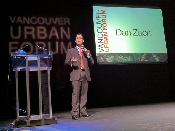
My Delightful Density Presentation at the Vancouver Urban Forum

(Photo from vancouverisawesome.com)
Last year I was lucky enough to be invited by former Vancouver Mayor Sam Sullivan to give a short-and-sweet version of my Delightful Density presentation. I gave my talk at the Vancouver Urban Forum, which was a great event organized by his current endeavor, the Global Civic Policy Society. I had a lot of fun, and my speech was pretty well received. Sam and his team were fantastic hosts, and it was exciting to be on the roster with urban luminaries such as Gil PeƱalosa, Ed Glaeser, and Gordon Price.

Here, for your viewing pleasure, is the presentation: 


The Vancouver Sun had a nice write-up on the event the next day, here. Vancouver has been a world leader in using well-designed density to revitalize their city, and they are consistently ranked at or near the top of most livable city lists thanks in large part to the work of people like Sam.

The bottom line is that a growing number of people prefer dense walkable urbanism, and it can be great when it is designed well and located in the proper place. Over the next few months, I plan to transcribe my Delightful Density presentation in to a series of blog posts for posterity. An extended version of the presentation, which includes a better density game and more data for folks who have yet to drink the Kool Aid, can be found on my Videos page.